
Visualize Your Real Service Territories
Stop managing territories from memory and spreadsheets. Organize providers, regions, and coverage areas with geographic precision - across ZIP and county boundaries.
Geographic business infrastructure, not just ZIP coloring
ZipCoverage is the operational layer for any business whose work has a footprint on a map.
Territory visibility
See every service zone, provider, and gap on one map - no more guessing what's covered.
Service area organization
Group ZIPs into regions, brands, or business units. Restructure in minutes, not weeks.
Provider management
Assign, reassign, and rebalance ZIP codes across providers, techs, franchises, or reps.
Geographic structure
Layer ZIP, county, region, and state views to match how your business actually thinks.
Operational flexibility
Overlapping coverage, shared zones, and shifting borders are first-class - not workarounds.
Expansion planning
Spot whitespace, model new territories, and pressure-test growth before you commit.
ZIP precision or county-level perspective
Switch between granular ZCTA detail and broader county (FIPS) views depending on the decision you're making.
Detailed local territory analysis
- Block-level service boundaries
- Technician routing and dispatch zones
- Hyper-local marketing and direct mail
- Per-ZIP demographic and demand signals
- Exact franchise/agreement borders
Broader regional visualization
- Multi-state and regional strategy maps
- Market sizing and expansion planning
- Federal and public-data alignment
- Executive dashboards and board reporting
- Coverage gaps across entire markets
Let AI read your map for you
ZipCoverage analyzes your provider structure, ZIP assignments, and regional density to surface what your team can't see manually.
Territory recommendations
AI proposes balanced provider boundaries based on density and demand.
Underserved regions
Identifies coverage gaps and demand pockets no provider currently owns.
Overlap opportunities
Detects healthy overlap vs. wasteful cannibalization between providers.
Expansion zones
Highlights the strongest adjacent ZIPs and counties for your next move.
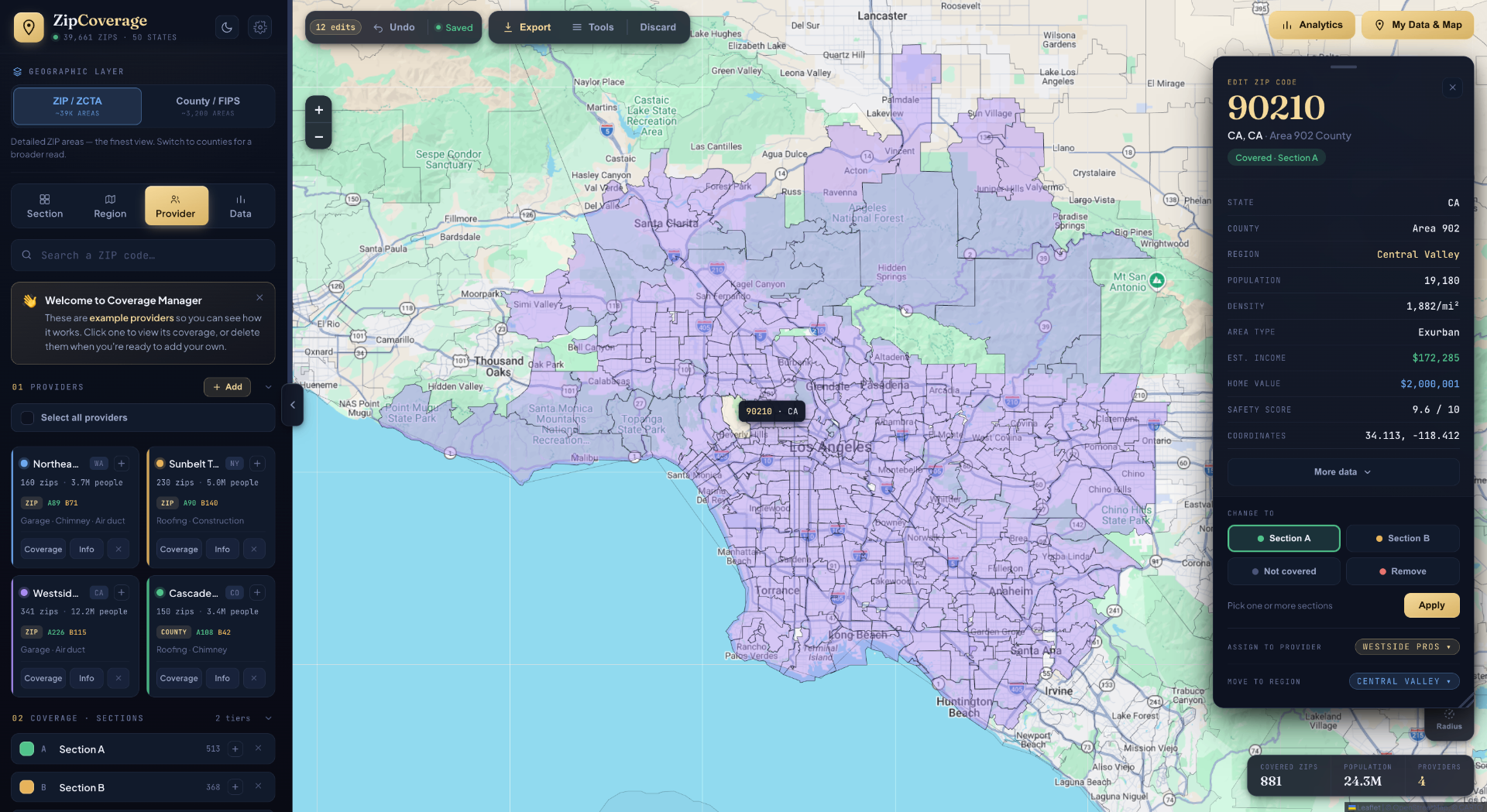
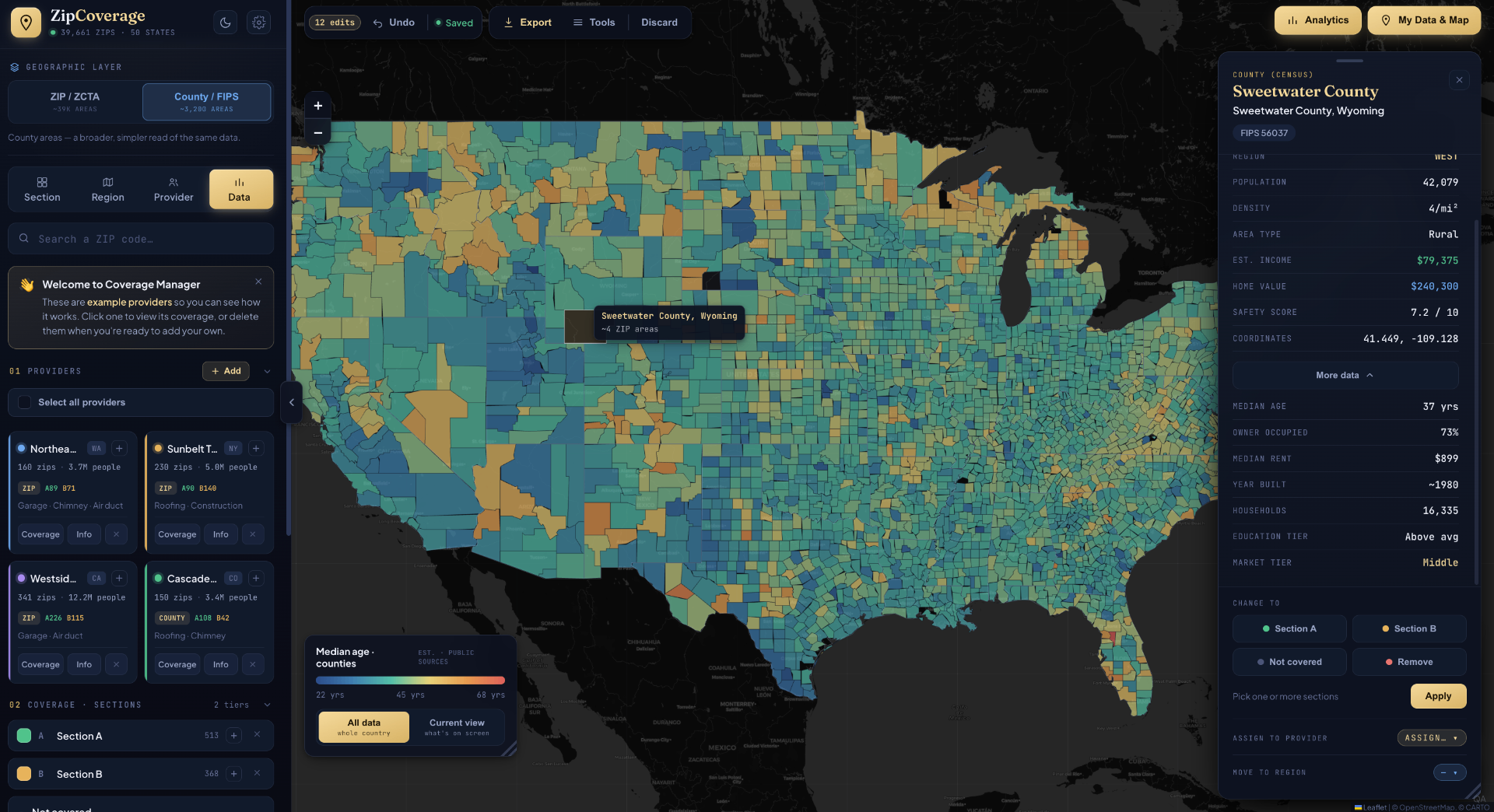
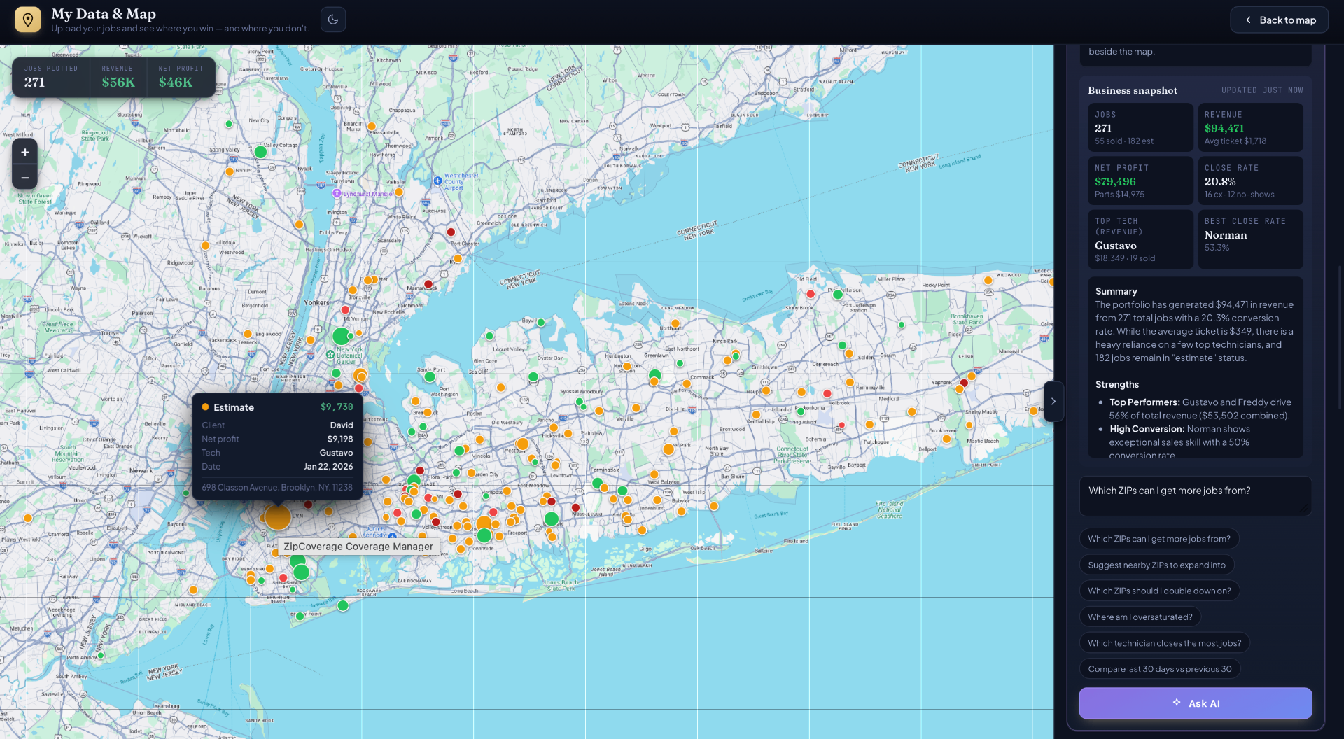
A look at the real interface
Actual screens from ZipCoverage — the same map, data panels, and analytics your team uses every day.
Workflows the platform was designed around
Franchise territory organization
Assign exclusive (or shared) ZIP territories per franchisee, with clear visual borders and dispute-proof maps.
Multi-provider coverage
Run several service brands or partners on one map. Allow overlap where it helps, prevent it where it doesn't.
Technician regions
Group ZIPs into tech routes and balance workload geographically. Rebalance in one drag.
Dispatch structures
Define hub-and-spoke dispatch zones with crisp ZIP-level rules your routing software can ingest.
Service radius planning
Model coverage radii around physical locations and clip them to real ZIP/county boundaries.
Marketing territory planning
Cut direct mail, paid media, and field marketing by precise territory - not bloated metro averages.
The data your territories sit on top of
Every chart and number below comes from the published product spec - nothing fabricated.
What you actually get for each ZIP
A small sample of the demographic and market signals attached to every ZIP code in the platform.
| ZIP | City, State | Population | Median income | Median home value | Owner-occupied |
|---|---|---|---|---|---|
| 10177 | New York, NY | 1,243 | $246,800 | $2.1M | 38% |
| 90210 | Beverly Hills, CA | 21,741 | $215,400 | $3.4M | 55% |
| 33139 | Miami Beach, FL | 44,210 | $72,300 | $612K | 32% |
| 75201 | Dallas, TX | 9,860 | $118,500 | $685K | 41% |
| 28202 | Charlotte, NC | 18,940 | $104,200 | $498K | 44% |
| 87501 | Santa Fe, NM | 32,150 | $58,900 | $465K | 62% |
Includes rent, vacancy, poverty, unemployment, education, age and more - across all 40,000+ ZIPs.
ZipCoverage.ai vs the alternatives
Setup time
Cost
ZIPs pre-mapped
Demographics built-in
Map visualization
Analytics dashboard
Learning curve
Lifetime updates
Works offline
| Feature | ZipCoverage.ai | Excel | Enterprise GIS |
|---|---|---|---|
| Setup time | 5 minutes | Hours | Weeks |
| Cost | $299 once | Free | $500+/month |
| ZIPs pre-mapped | ~40,000 | ✗ | ✗ |
| Demographics built-in | ✓ | ✗ | Add-on |
| Map visualization | ✓ | ✗ | ✓ |
| Analytics dashboard | 6 tabs | ✗ | Limited |
| Learning curve | 5 min | OK | Steep |
| Lifetime updates | ✓ | N/A | ✗ |
| Works offline | ✓ | ✓ | ✗ |
Ready to stop juggling spreadsheets?
From $299. Premium territory intelligence - no subscription on Individual.